Kinmel Bay Flood Resilience
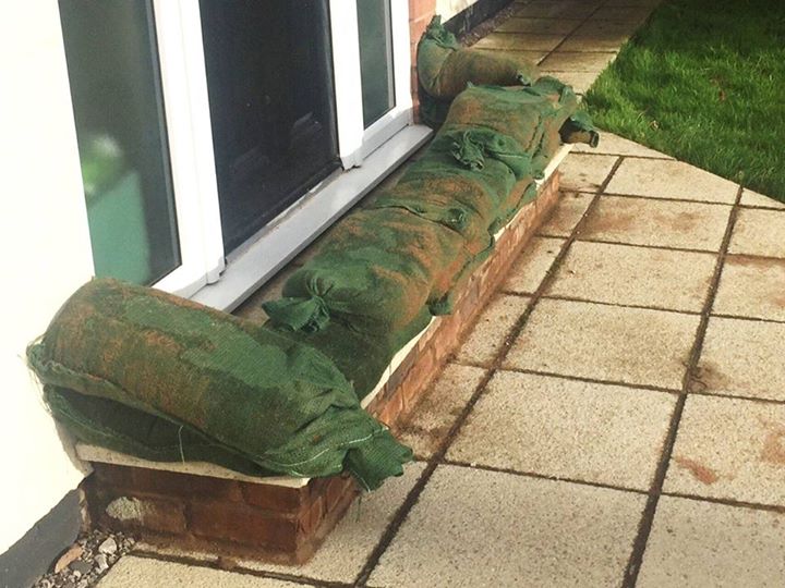
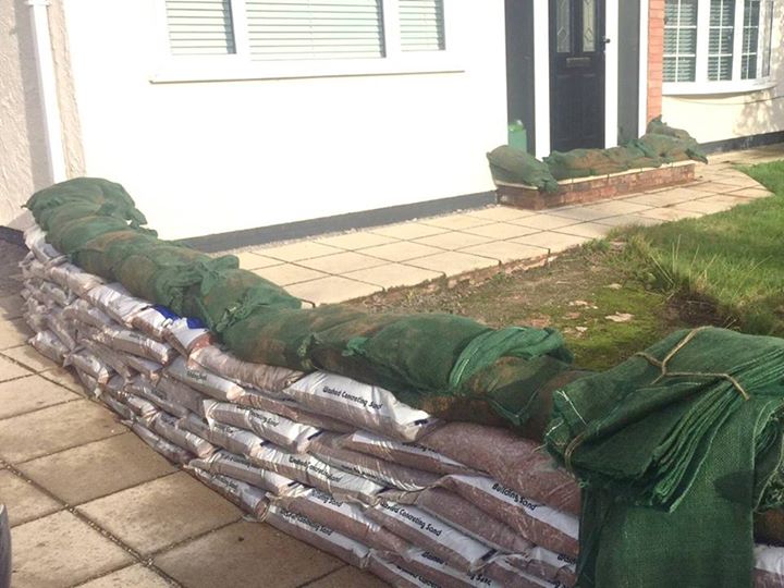
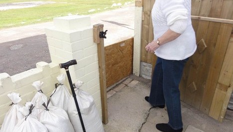
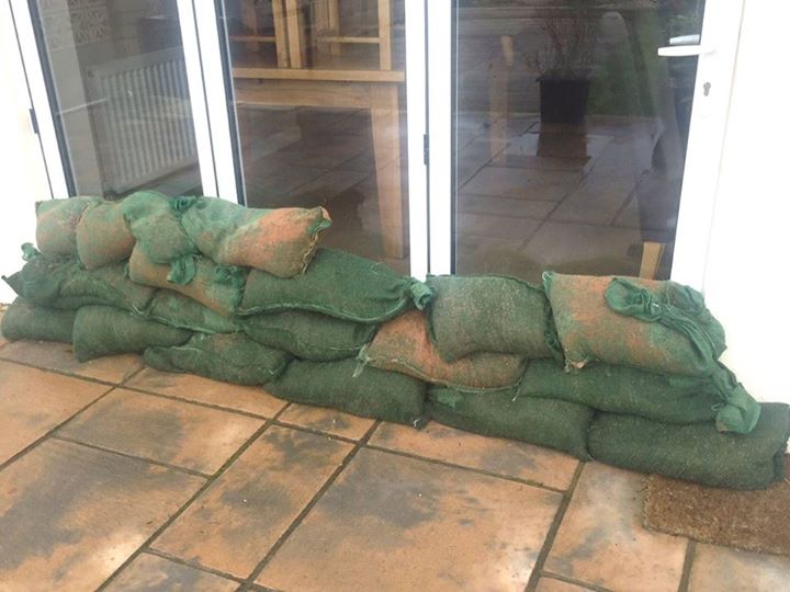
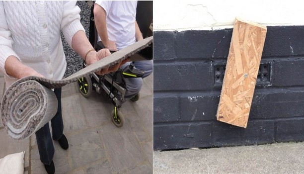
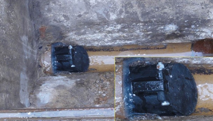
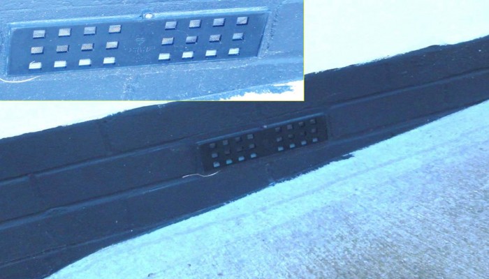
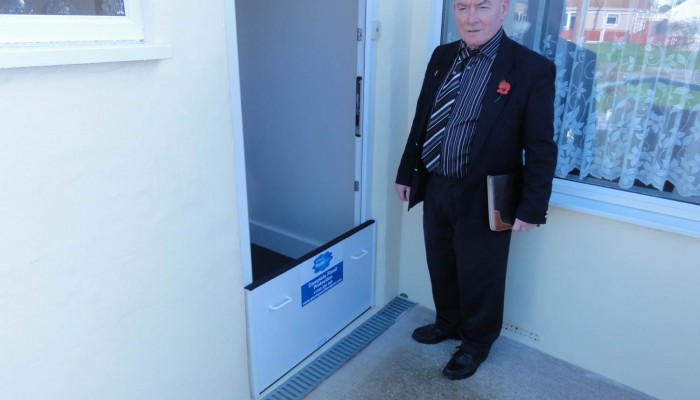
If we expect a flood and want to protect our property sand bags are an option but consider the work involved at short notice, assuming we have filled sand bags ready to use. These photos of a few £00's of sand bags on a sunny day last week in St Asaph after the emergency measures of the evening before don't relate to the circumstances of a flood warning. Further, have we covered all the options, a sandbag down the loo and one over the shower drain? air bricks? will the wall hold? Ideally we plan resilience measures ahead of the urgent need and this is a complex process needing informed advice, where do we get it? some good idea here http://your-biz.org/diy-resilience/

|
|

|
|

|
Special AdviceSandy Cove residents are at risk to coastal floods and should be prepared to avoid or to safely endure flooding. Sandy Cove flooding is at its greatest risk around periods of high tide and when other weather conditions including on-shore winds and low atmospheric pressure coincide; as was the recent case on 5 December 2013. The Sandy Cove community is close and would ideally share care for vulnerable people and let the flood wardens know of any concerns in advance of high tide periods or forecast storm conditions. You may know someone who is disabled who would need to be planned for or someone at risk who is away from home at the time of a flood. The role of the community in flood management is crucial. Plan ahead to identify places of upper floor refuge near where you and any vulnerable neighbours, let the wardens know what plans you have for sitting-out a flood if that became necessary. Prepare an emergency kit and take precautions to move valuables, pets etc. to a safe place. It is important that you sign-up for flood alerts and warnings. General recommendations from Natural Resources Wales (NRW) are contained on this website.
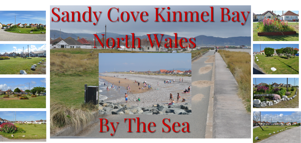
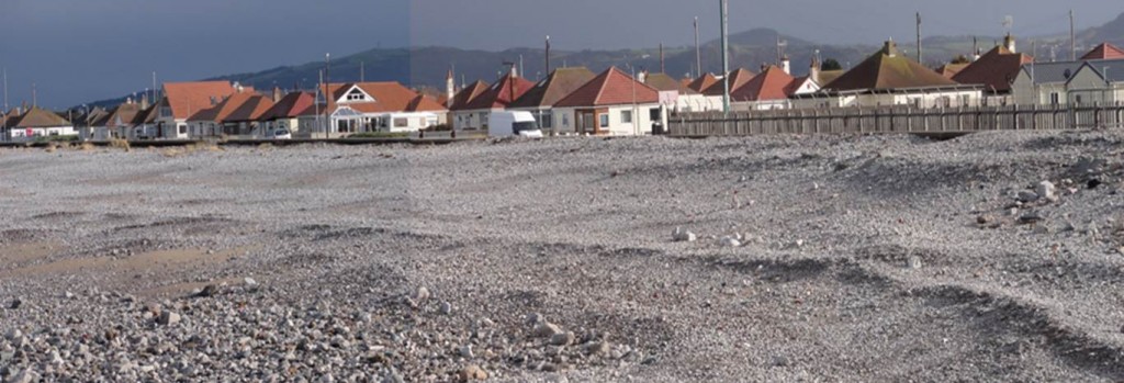
General InformationSandy Cove is a residential area between Kinmel Bay and Towyn. The beachside community of some 250 homes was not completed by the developers in the 1950’s leaving the residents with un-adopted roads and no surface drainage. This is a vulnerable community with a number of disabled and elderly residents. In the event of a flood or other emergency it would be more difficult for emergency services to access some parts of the community. There are relatively few homes with upper floor refuge. A low sea wall has banked to the top with shingle and sea water overtops occasionally to the properties occasionally below the high tide level.
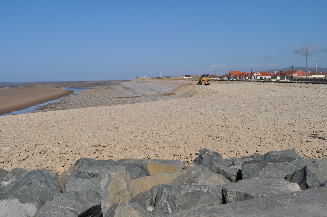
Sandy Cove PromenadeThe promenade at Sandy Cove runs between Kinmel Bay to the East and Towyn to the West. Private homes border the prom and extend back to Foryd Road. A low wall forms sea defence between mainly single storey bungalows and the shingle beach.
Progressively over time the shingle embankment has been pushed up by tides to the top of the wall and high tide overtopping occurs regularly to varying degrees.
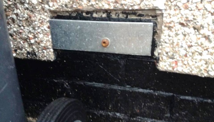
Residents are concerned about flooding and a strong community share this concern which is exacerbated by the lack of rods, pavements and rainwater drainage. Sandbagging is occasionally applied to properties and openings and serious consideration should be given to ensuring adequate supply and correct placemat of sand bags takes place.
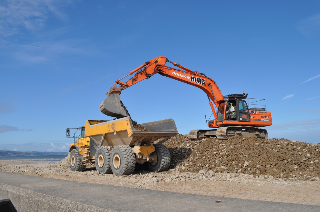
Shingle BeachFrom the photos it can be seen that the homes in Sandy Cove are to a degree below water level when tides approach overtopping.
Pre-flood resident and Warden surveillance could include inspection of the shingle level. Concern has already been expressed about the extent to which the sea defences are adequate and this is a matter to be followed through local representatives.
For the community flood plan we need to maintain surveillance and signal any deterioration or concern via the flood warden or councillors.
Where shingle spills onto the prom this can impede cyclists, walkers or on emergency may restrict progress and this needs to be reported through the flood warden process in this community flood plan.
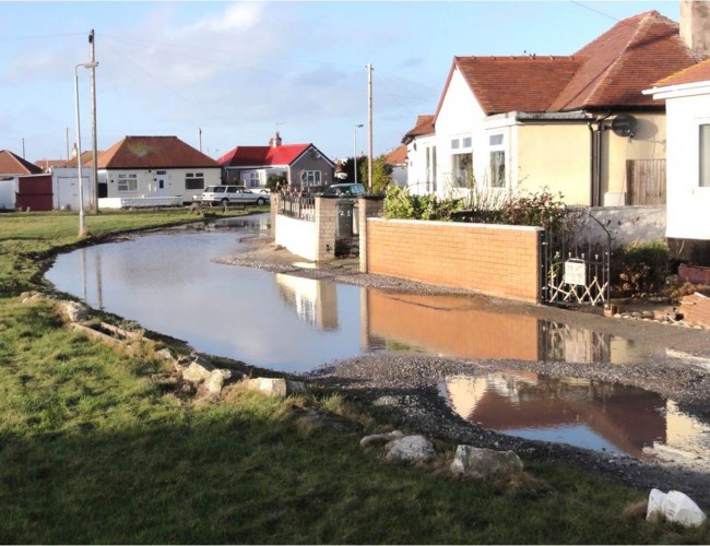
Recent FloodingResident photos show recent sea water flood inundation as it overtops the low wall and flows quickly through the Sandy Cove residential area. Residents and wardens need to prepare for the speed with which these events occur and to be safely vigilant particularly at periods of higher tides.
The obvious questions of flood protection are raised by these images with the resultant flooding made worse due to saturated low laying ground (no rainwater drains).
In this recent case a few homes were flooded and many had a very close escape from evacuation and many months in temporary accommodation – the after flood consequences.
Sandy Cove InfrastructureSandy Cove is a community without roads or foot paths and this has significant implications for resident safety in an emergency also making the role of emergency services more difficult and a greater risk.
In addition there is no rainwater (or flood water) drainage system so waterlogged ground impedes flood drainage and adds to the difficulty for disabled and able bodied residents and flood wardens to move about the area.
A relatively small number of properties have 1st floor accommodation and it would be important for the flood plan to address emergency refuge as part of the community flood plan.
General InformationSandy Cove is a residential area between Kinmel Bay and Towyn. The beachside community of some 250 homes was not completed by the developers in the 1950’s leaving the residents with un-adopted roads and no surface drainage. This is a vulnerable community with a number of disabled and elderly residents. In the event of a flood or other emergency it would be more difficult for emergency services to access some parts of the community. There are relatively few homes with upper floor refuge. A low sea wall has banked to the top with shingle and sea water overtops occasionally to the properties occasionally below the high tide level.
Sandy Cove PromenadeThe promenade at Sandy Cove runs between Kinmel Bay to the East and Towyn to the West. Private homes border the prom and extend back to Foryd Road. A low wall forms sea defence between mainly single storey bungalows and the shingle beach.
Progressively over time the shingle embankment has been pushed up by tides to the top of the wall and high tide overtopping occurs regularly to varying degrees.
Residents are concerned about flooding and a strong community share this concern which is exacerbated by the lack of rods, pavements and rainwater drainage. Sandbagging is occasionally applied to properties and openings and serious consideration should be given to ensuring adequate supply and correct placemat of sand bags takes place.
Shingle BeachFrom the photos it can be seen that the homes in Sandy Cove are to a degree below water level when tides approach overtopping.
Pre-flood resident and Warden surveillance could include inspection of the shingle level. Concern has already been expressed about the extent to which the sea defences are adequate and this is a matter to be followed through local representatives.
For the community flood plan we need to maintain surveillance and signal any deterioration or concern via the flood warden or councillors.
Where shingle spills onto the prom this can impede cyclists, walkers or on emergency may restrict progress and this needs to be reported through the flood warden process in this community flood plan.
Recent FloodingResident photos show recent sea water flood inundation as it overtops the low wall and flows quickly through the Sandy Cove residential area. Residents and wardens need to prepare for the speed with which these events occur and to be safely vigilant particularly at periods of higher tides.
The obvious questions of flood protection are raised by these images with the resultant flooding made worse due to saturated low laying ground (no rainwater drains).
In this recent case a few homes were flooded and many had a very close escape from evacuation and many months in temporary accommodation – the after flood consequences.
Sandy Cove InfrastructureSandy Cove is a community without roads or foot paths and this has significant implications for resident safety in an emergency also making the role of emergency services more difficult and a greater risk.
In addition there is no rainwater (or flood water) drainage system so waterlogged ground impedes flood drainage and adds to the difficulty for disabled and able bodied residents and flood wardens to move about the area.
A relatively small number of properties have 1st floor accommodation and it would be important for the flood plan to address emergency refuge as part of the community flood plan.
|
|
